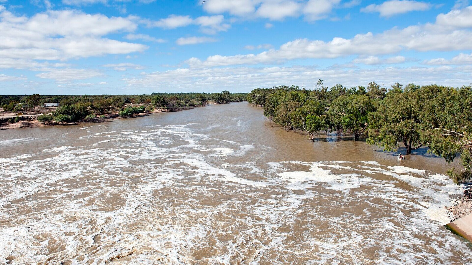
The Darling River flowing past the Main Weir at Menindee Lakes, outback NSW

The Darling River Run

730km of river gums, pub towns and Menindee sunsets — the Bourke-to-Wentworth run is outback NSW’s great pilgrimage.

Free

The Darling River Run is outback NSW’s great pilgrimage: roughly 730km shadowing the river from Bourke to Wentworth, through paddle-steamer ports, pub towns of a dozen people, and the astonishing lakes and sunsets of Menindee. It’s remote, slow and completely unforgettable.

The route

From Bourke — the “gateway to the real outback” — river roads run both banks through Louth and Tilpa (sign the pub wall), to Wilcannia’s sandstone heritage, Menindee’s lakes and Kinchega’s shearing history, finishing where the Darling meets the Murray at Wentworth.

Need to know

  • Mostly unsealed: fine for 2WD in dry weather, impassable after rain — check conditions daily.
  • Fuel and water discipline matter: Bourke, Louth, Wilcannia, Menindee, Pooncarie.
  • Allow 3–5 days; the pubs are the itinerary.

Add the Menindee sunset to your photography list.

🏅 Own or manage this place? Get your “Featured on AustralianSecret” badge

Show visitors you're featured in our independent directory — copy this snippet into your website. The badge links back to your listing here.

Featured on AustralianSecret

Watch

Key Stops Along the Way

  1. Bourke — Back O' Bourke Exhibition Centre
  2. Tilpa — Sign the pub wall
  3. Wilcannia — Sandstone river-port heritage
  4. Menindee Lakes — Sunsets and Kinchega NP
  5. Pooncarie — River pub stop
  6. Wentworth — Darling meets the Murray

Frequently Asked Questions

Do I need a 4WD for the Darling River Run?

Not in dry conditions — the river roads are graded dirt suitable for careful 2WD. After rain they close entirely; check local condition reports daily.

How many days does it take?

Three days minimum, five comfortably — distances are long and the pubs, lakes and heritage towns are the point.

When is the best time to go?

April to October, for mild temperatures and dry roads. Summer out here regularly tops 40°C.

Where do you refuel?

Bourke, Louth, Wilcannia, Menindee and Pooncarie — top up at every opportunity and carry water regardless.

Location & Map

Last updated

Share this

Nearby

More to Explore in New South Wales

View all

Bylong NSW Free

Bylong Valley Way

The scenic shortcut between Hunter wine country and Mudgee — sandstone gorges, horse studs and the silent Bylong…

FreeFamily

Coffs Harbour NSW Free

Sydney to Byron Bay Coastal Drive

The east-coast classic done properly — 770km and three days of surf towns, river ferries and hinterland between…

FreeFamily

Long Flat NSW Free

Oxley Highway (Walcha to the Coast)

300+ bends off the Great Dividing Range — the Oxley’s Walcha-to-coast run is a rider’s pilgrimage with gorge…

Free

Nowendoc NSW Free

Thunderbolts Way

Bushranger country — from Gloucester’s dairy valleys over the highest sealed road country in NSW to Walcha and…

FreeFamily

Know a Place Worth Sharing?

Run a farm stay, cafe, winery or unique experience? Get in front of thousands of Australian travellers searching for exactly what you offer.