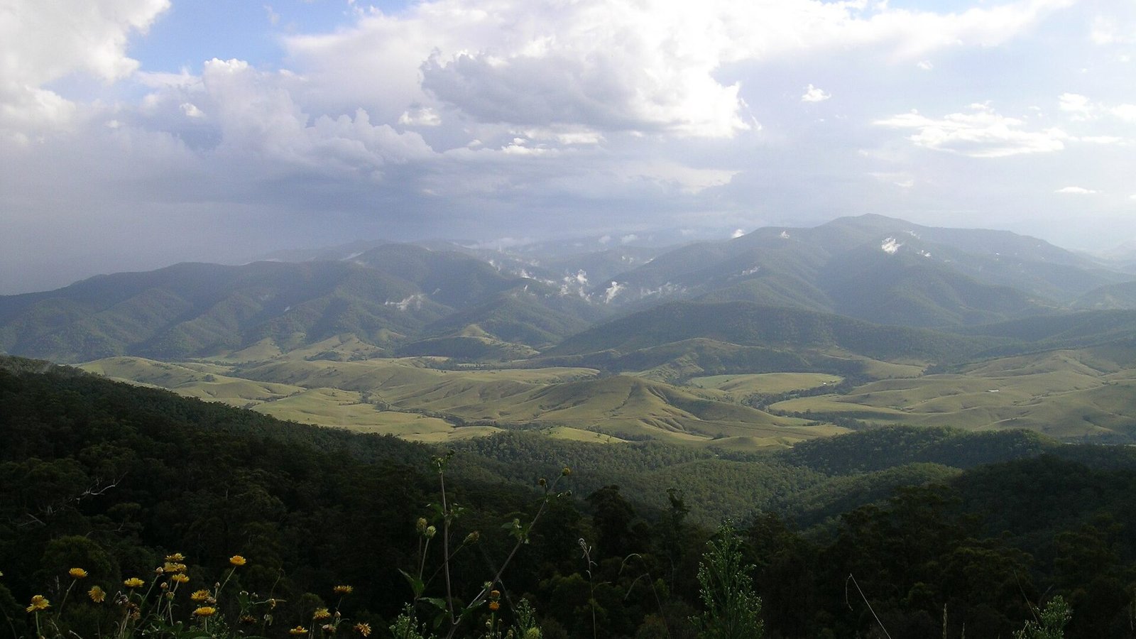
The Manning Valley from Carsons Lookout on Thunderbolts Way, NSW

Thunderbolts Way

Bushranger country — from Gloucester’s dairy valleys over the highest sealed road country in NSW to Walcha and Uralla, big skies all the way.

FreeFamily

Named for the bushranger who worked these hills, Thunderbolts Way climbs from Gloucester’s dairy valleys to the highest sealed country in NSW around Nowendoc — a big-sky drive of escarpment lookouts, empty high plains and river gorges that most coast-bound traffic never sees.

The route

Out of Gloucester the road rises fast; Carsons Lookout delivers the Manning Valley in one sweep. The high country runs cool and open through Nowendoc to Walcha (detour: Apsley Falls), finishing at Uralla beside Thunderbolt’s grave itself.

Need to know

  • It’s cold up top — often 10°C below the coast; pack accordingly even in summer.
  • Fuel at Gloucester, Nowendoc (limited) and Walcha.
  • Combine with the Oxley Highway for the classic New England loop.

Stay options along the way in our unique stays directory.

🏅 Own or manage this place? Get your “Featured on AustralianSecret” badge

Show visitors you're featured in our independent directory — copy this snippet into your website. The badge links back to your listing here.

Featured on AustralianSecret

Watch

Key Stops Along the Way

  1. Carsons Lookout — The Manning Valley in one sweep
  2. Nowendoc — High-plains halfway point
  3. Walcha — Sculpture town and Apsley Falls detour
  4. Uralla — Thunderbolt's grave and cafes

Frequently Asked Questions

Who was Thunderbolt?

Frederick Ward, the gentleman bushranger who ranged this high country in the 1860s — his grave is at Uralla at the route's end.

Is Thunderbolts Way fully sealed?

Yes, the Gloucester–Uralla route is sealed throughout, though it's narrow and winding on the big climb out of Gloucester.

What's the best stop on the route?

Carsons Lookout, twenty minutes above Gloucester — the whole Manning Valley unrolls below the escarpment.

How cold does it get up top?

The Nowendoc plateau sits above 1,000m and often runs 10°C below the coast — winters bring frosts and occasional snow.

Location & Map

Last updated

Share this

Nearby

More to Explore in New South Wales

View all

Bylong NSW Free

Bylong Valley Way

The scenic shortcut between Hunter wine country and Mudgee — sandstone gorges, horse studs and the silent Bylong…

FreeFamily

Coffs Harbour NSW Free

Sydney to Byron Bay Coastal Drive

The east-coast classic done properly — 770km and three days of surf towns, river ferries and hinterland between…

FreeFamily

Menindee NSW Free

The Darling River Run

730km of river gums, pub towns and Menindee sunsets — the Bourke-to-Wentworth run is outback NSW’s great pilgrimage.

Free

Long Flat NSW Free

Oxley Highway (Walcha to the Coast)

300+ bends off the Great Dividing Range — the Oxley’s Walcha-to-coast run is a rider’s pilgrimage with gorge…

Free

Know a Place Worth Sharing?

Run a farm stay, cafe, winery or unique experience? Get in front of thousands of Australian travellers searching for exactly what you offer.